Briefing Météo | |||
| |
|||
Image satellite WV composite
| |||
Vorticity 500hpa (6h)
| |||
Vorticity 500hpa (21h )
| |||
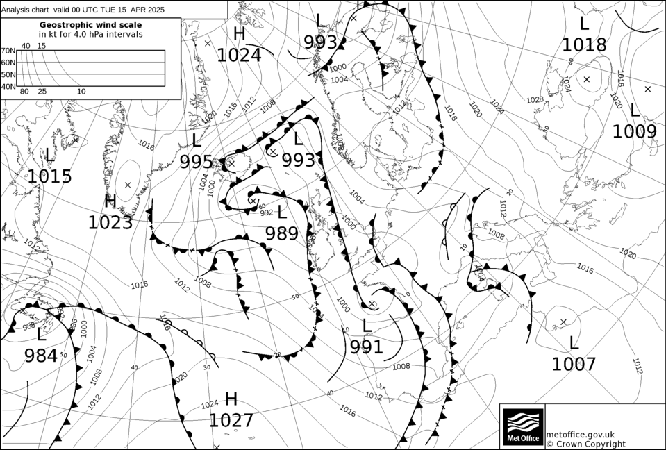
Analyse fronts en surface
| |||
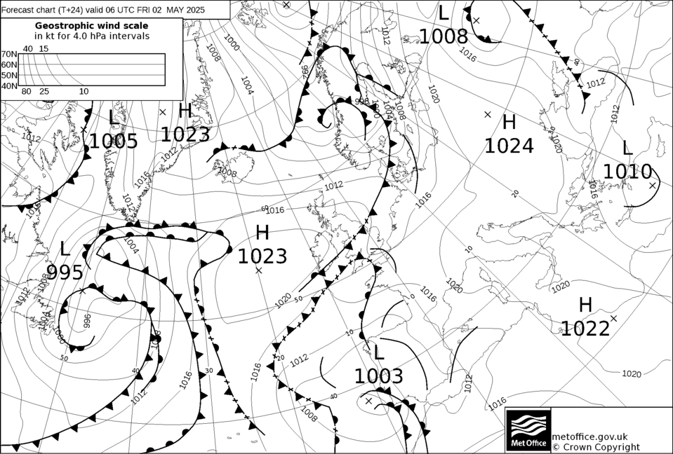
Analyse fronts en surface (+24h)
| |||
Images satellite visible Europe (click, IR)
| |||
Images satellite visible France (click, dernière)
| |||
Vents (interactif)
| |||
Radar précipitations
| |||
Prévision précipitations
| |||
Geopotentielles et VV à 700hpa
| |||
Nébulosité
| |||
| |||
Remerciements pour tous les sites indexés. |
Page mise en forme par MicroClimats (Version 8.32/09-25 ) |
||